What an Iasoberg™ Subscription Gives You
As a subscriber to the Iasoberg™ Technology, you can view the Technology's output in relation to current weather and geophysical events — some of them major — in or near your location. Because the model computes any instant between 2500 BC and 2500 AD, those observations apply equally to moments in the past and the future.
Output for Your Location
View the iasoberg™ bands and forces for your own region, delivered as monthly KMZ files you can open and explore in Google Earth.
Severe-Weather Awareness
See the Technology's forecasts for the potential of large hail events and tornado outbreaks across the continental United States.
Geophysical Correlation
The Technology is being used to identify possible timing and locations for 7+ earthquakes, based on the patterns of past 8+ earthquakes.
Real-Time Updates
Receive updates in real time as the Technology is continually refined and its correlations sharpened.
On the Horizon
We are investigating the correlation of the Technology's output with the U.S. government study on Total Electron Content (TEC) — an area emphasized by the Space Weather Prediction Center — and with Clear Air Turbulence (CAT). CAT is largely benign today, causing passenger discomfort; but as global warming accelerates, it is expected to become a significant factor in air travel, and the Iasoberg™ Technology could play a major role in predicting it.
What You'll Receive
Subscribers receive professional Iasoberg™ Technology forecast sheets — for tornado, hail, and wind — each pairing the official NOAA Storm Prediction Center probability map with the Technology's own analysis, a LOW / MID / HIGH risk legend, and a split-calendar marking the days identified as potential outbreak days. Each sheet is also delivered as a monthly KMZ file you can open and explore in Google Earth.
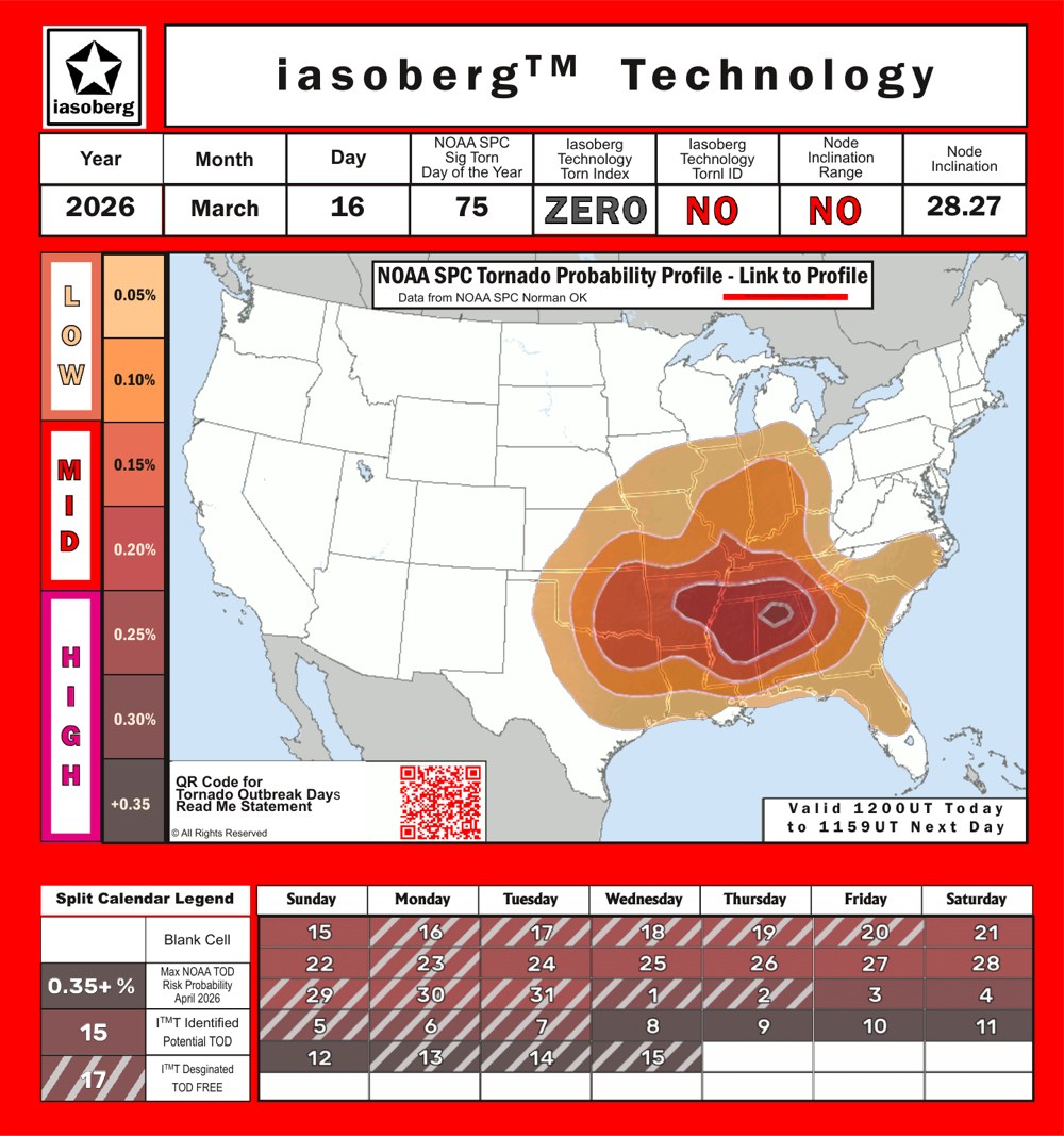
Access is quick and visual: each forecast category — Tornado, Hail, and Wind — has its own colour-coded QR code, so you can scan straight to the output you need.

How to Subscribe
Subscriptions are being prepared
We are putting the final pieces in place for Iasoberg™ subscriptions, including access to the monthly KMZ output for your region. In the meantime, get in touch and we'll add you to the list and answer any questions.
Instructions for importing KMZ files into Google Earth will be provided to subscribers.